Gallatin County Future Land Use Map & Housing Strategy
The Gallatin County Future Land Use Map is a tool intended to guide where and how we grow based on the values of our community. Many, many hours of hard work by the public, stakeholders, and technical experts have gone into envisioning and informing the Future Land Use Map.
The Gallatin County Commission will vote for or against adoption of the FLUM and the Housing Strategy (HS) on Tuesday, December 10th at 9 am at the Gallatin County Courthouse – 311 W. Main Street in the Community Room.
There is still time to engage to ensure that the Future Land Use Map considers water, wildlife, and open space, as well as guides growth toward community centers and existing infrastructure.
To be a voice for wildlife, water, recreation, clean air, and public health and safety:
Read the public comment from the Gallatin Watershed Council HERE.
Email your comments to envision@gallatin.mt.gov
Show up to the hearing in person or virtually on Tuesday December 10th at 9 am at the Gallatin County Courthouse – 311 W. Main Street in the Community Room.
Share with your friends and neighbors.
Take a deeper dive into the draft Future Land Use Map HERE.
General Tips for Public Comment:
Tell the County about what you value as a resident of Gallatin County. Here’s an example: “Hi, my name is _____, and I value wildlife because…I hunt with my kiddo and want this to be a lifelong love for them. I care about ensuring intact wildlife habitat and that the joy of being in wild places will endure in the future. Thank you.”
Gallatin Watershed Council Guidance to the Future Land Use Map
The Gallatin Watershed Council has been working hard to give water a seat at the table. Here are the facts about water in the FLUM:
The FLUM incentivizes growth to be connected to public water and sewer facilities.
Septic systems just aren't great at removing nitrogen. Septic proliferation is one of the leading causes of water pollution in the Gallatin Watershed, resulting in elevated nitrate levels in drinking water wells and algal blooms in our rivers and streams. Centralized wastewater facilities provide a much higher level of treatment and are regulated by a discharge permit.
Exempt groundwater wells impact an already strained water system, affecting downstream water users and the volume of water flowing in our streams and rivers. And we don’t have any to spare. We share this limited supply of water. Cities, towns, and farmers legally have the right to use more water than Mother Nature supplies each year. Every drop pulled from the ground counts.
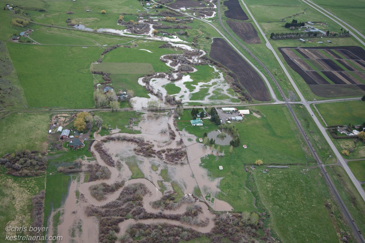
The FLUM discourages development in highly sensitive and high-risk areas.
Currently, 60-83% of homes in Gallatin County are built in the Wildlands-Urban Interface (WUI). These homes are vulnerable to wildfires and wildlife conflicts. Building outside of areas that prone to wildfires protects communities and allows for management practices that promote healthy forests that are less susceptible to mega-fires.
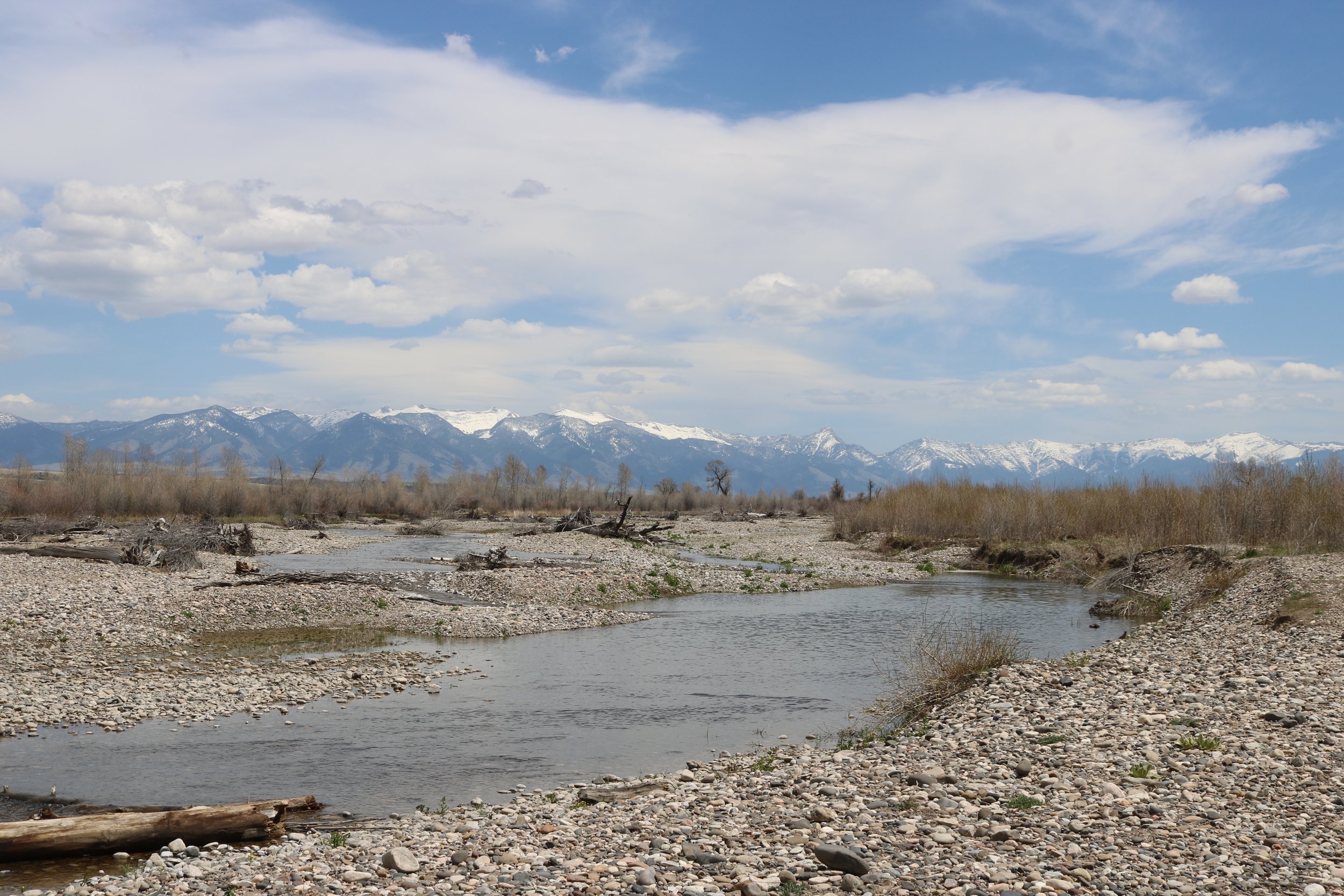
The Watercourse Commons has been included in the FLUM as a compilation of spatial data layers that represent our most sensitive and high-risk landscapes including floodplains, channel migration zones, and riparian areas. Rivers and streams need space to flood, erode, and support riparian vegetation in order to minimize risk to infrastructure and property, naturally slow and store water, provide fish and wildlife habitat, and treat and filter pollution to maintain clean water. Did you know that riparian areas account for only 4% of Montana’s land cover, but almost all of Montana’s wildlife depend on them for habitat?
The FLUM connects open spaces.
Driving growth towards existing infrastructure makes efficient use of land and water resources. Open space benefits us all, ensuring rivers can roam, wildlife can migrate, and farmers can farm.
Contiguous farmable land is critical for agricultural operations and sustainable water management in the Gallatin Watershed. Agricultural water users work together to maintain almost 1,000 miles of canals and ditches across the Gallatin Valley. These ditches convey water for crops, manage floodwater and stormwater, and distribute water across the valley to recharge the aquifer and support late-season flows in our rivers and streams.
The FLUM indicates areas with high groundwater nitrate levels.
Areas of high groundwater nitrate concentrations have been identified across the Gallatin Valley. Groundwater nitrate levels above 2 mg/L are commonly considered to have surpassed natural background concentrations and be influenced by human land use practices. Nitrate poses a direct human health risk at concentrations above 10 mg/L. Identifying areas with elevated nitrate can help limit additional loading from new septic systems and avoid contaminated drinking water wells.
Groundwater and surface water in the Gallatin Valley are closely tied together by a cobbly alluvial aquifer. Polluted groundwater means polluted streams. The Montana Department of Environmental Quality considers 15 streams in the Lower Gallatin Watershed impaired and unable to sustain a healthy trout fishery and/or provide safe recreation. High nitrate levels in groundwater, in large part due to septic influence, are cited as a primary cause.
The FLUM indicates areas that have the highest potential for groundwater recharge.
The East Gallatin River and lower reaches of the Gallatin River are particularly vulnerable to dewatering and often run critically low in the summer months. Diverting abundant spring runoff to recharge the aquifer in the benchlands surrounding the Gallatin Valley can support these reaches with a steady supply of groundwater when they need it most. These are areas where the alluvial aquifer is deep and can hold a lot of extra water and which have an existing canal distribution network to get the water there.
The aquifer within the Triangle Area, between the Gallatin and East Gallatin Rivers, also plays an important role in supporting in-stream flow. Currently, there is not much extra room for storage here because groundwater levels are already so high, but aquifer recharge in this area could become more integral in the event of future groundwater draw-down.
Future land use changes should maintain the opportunity to leverage areas of high groundwater recharge potential for the sake of watershed health and long-term water security.
Click HERE for a downloadable version of this guidance.
Learn more about how GWC engaged in the first round of FLUM public feedback HERE.